
Explore, Navigate, Search, Track, Enjoy
Integrate an interactive indoor map in your solution with all the functionality that the users of today expect. Let the indoor maps reflect buildings, brands and data as you like and allow users to enjoy the emerging indoor map experience - directly inside your product or as a stand-alone map.

Simple 2D and full-blown 3D experience
Geo-referenced on real world coordinates
All your real-time data in one single map
Faster map maintenance and updates with Al
Native SDKs for web, iOS, and Android
Outdoor to indoor navigation
25,000 buildings mapped
99.99% uptime
Make It Your Map
Determine your own mapping style with just the look, feel, and functionality that fit your needs or opt for the pre-determined best practice map style.


Search and Find Anything on the Map
Guide users with personalized, user-friendly directions, setting a new standard for ease and accessibility.


Decide what should be searchable.
All elements on the map are separated and can be made clickable and named in the CMS.

Make your search results relevant.
Filter searches to specific buildings, areas, venues, floors, categories, or types, like restrooms and workstations to help users find what they need.

Search outside the buildings.
Leverage your base map for searches outside of the mapped buildings, like a nearby coffee shop or parking space.
Get Wayfinding out of the Box
Slice and dice your map data and control what is searchable, how search results are displayed, and who can search for what.


Auto routes with MapsIndoors AI
Ensure optimized wayfinding efficiency of your indoor maps at all times. MapsIndoors AI dynamically adapts routes around obstacles and any layout changes. Designate any area as an obstacle, even invisible zones for restricted access, and no map update will hinder a smooth, uninterrupted user journey.
Visualize Dynamic Live Data on the Map
Let your data come to life with the visualization of your indoor maps. Use the map features to illustrate condition, state, and details.


Building more retention into your product with data
Connect live data sensors, calendar booking systems, ERP systems, and more to enrich your indoor map as a centralized user hub.
Display external dynamic data to enhance the map's utility, relevance, real-time applicability, and customization for specific use cases.
By dynamically adapting the visualization of your indoor map data, you get a unified, up-to-date, and contextually relevant digital twin that ensures a full user experience.
Manage Your Maps in Real-Time
Easily add, edit, and maintain your indoor map styling and content in the MapsIndoors Content Management System.

Eliminate back-and-forth email chains with instant map updates
Act and deliver immediately on your customers' needs for map updates or changes through the CMS self-service.

Map Update Automation
Updated maps are crucial for increasing engagement. If your maps are not up-to-date, users stop trusting them and stop using them.
Map Update Automation is a one-step process where you upload your latest floor plan and let our AI-powered map engine, MapsIndoors AI, handle the rest.
Powered by MapsIndoors AI, the process covers all coordination, detection of floor plan changes, and implementation of all map updates regardless of frequency or volume.
Getting the Indoor Map into Your Product
Whether you prefer the flexibility of SDKs, the ease of Flutter and React Native, or the simplicity of a pre-built web app, the MapsIndoors platform has got you covered.

Native web and mobile SDKs
Opt for the advanced solution with endless customization and integration options. The native SDKs on web, iOS, and Android give you complete freedom in your implementation and customization.

Web app
For a low effort implementation with best practice map functionality, get a finalized MapsIndoors solution for immediate use as a URL, iframe or embedded web app, or use the source code to fast-track your project.

Flutter and React Native
Integrate our mobile SDKs into your React Native or Flutter projects. Our mobile SDKs are optimized for seamless compatibility, ensuring a smooth implementation tailored to your framework of choice.

Developer documentation
Guiding you through every step of your implementation, the MapsIndoors Developer Docs offers comprehensive guides, tutorials, and reference materials designed to make your implementation process fast and easy.
Go to docs site
Indoor Maps in the Outside World
Easily add, edit, and maintain your indoor map styling and content in the MapsIndoors Content Management System.
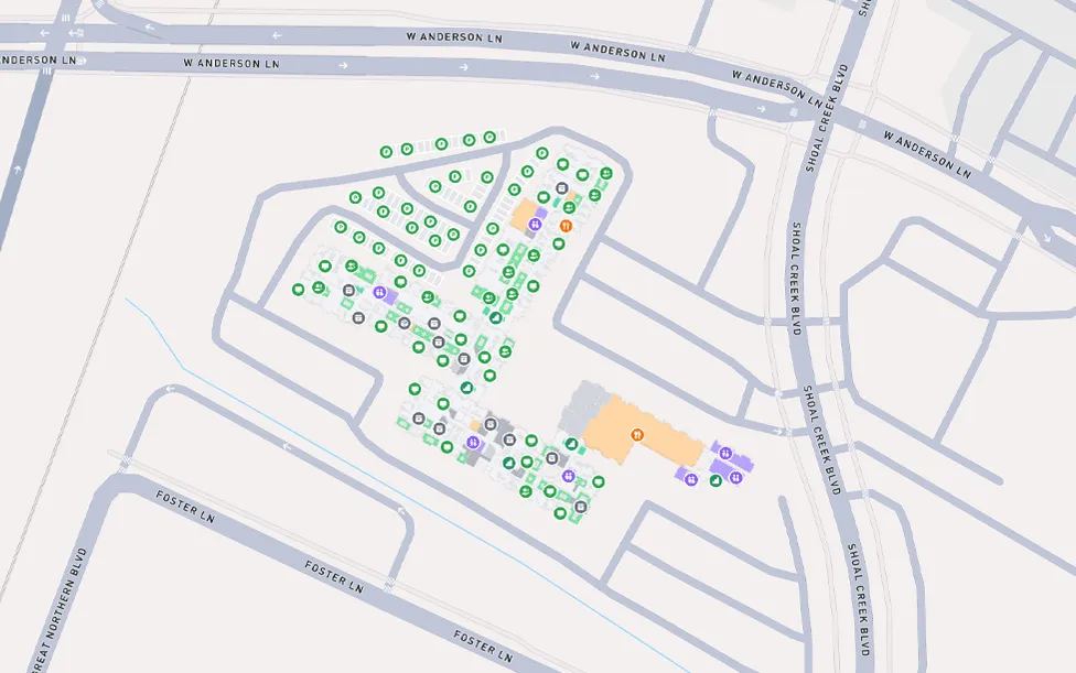


Outdoor to indoor navigation
Smooth transition for uninterrupted wayfinding between outdoor and indoor spaces.

Many buildings in one map
Combine buildings, venues, campuses, etc. in the same map solution with easy navigation between them using the outdoor map.

Outdoor points of interests
Make outdoor points of interest and map markers appear and disappear on your map as you see fit.

Stand out as a landmark
Include custom 3D landmark models of your buildings to stand out on the outdoor map.
Book a demo with
Stevie
or
Christine
