Design smarter airport experiences, from the gate to the back office


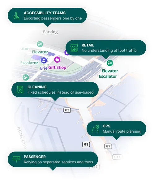
One passenger journey, five disconnected systems, and gaps no one can see
Every team in your airport works hard to deliver a smooth experience. But disconnected systems force them to operate in isolation.
The result? Duplication, inefficiency, and passengers falling through the cracks.
You don’t just need better tools—you need a shared layer that connects them.
Improve Your Airport Experience with MapsIndoors

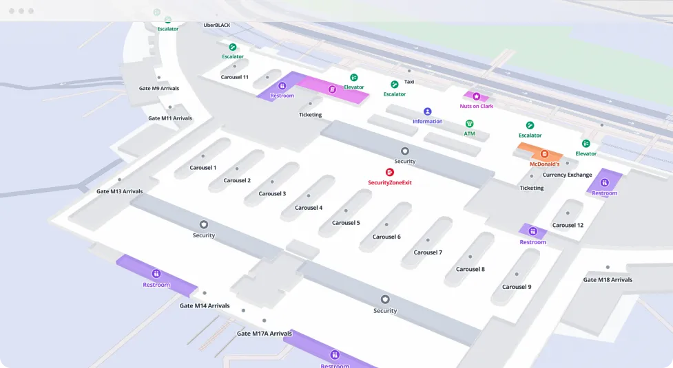
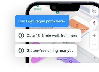
By combining real-time data with spatial intelligence, the airport map becomes a digital companion — guiding passengers based on what matters in the moment. Whether that’s how long it takes to reach the gate, when queues build up, or finding your preferred dining option, the experience adjusts to serve the traveler. No stress. Just a smarter way to move, explore, and enjoy the terminal.
— Guide travelers based on context and location
— Adapt to live changes across the terminal
— Help travellers find food, services, and amenities
— One map across app, web, and kiosk touchpoints
Airports are full of disconnected tools and duplicated data. MapsIndoors acts as a digital foundation that brings everything together—from operational systems and IoT feeds to passenger-facing services. Instead of building multiple solutions for different teams, you get one flexible map that serves all of them.
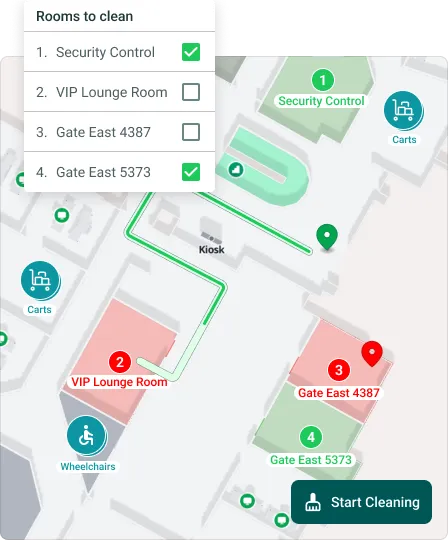
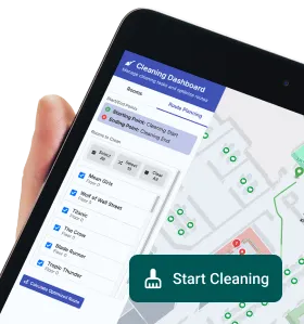
From cleaning crews to maintenance staff and mobility services, airports run on coordination. MapsIndoors helps teams spend less time figuring out where to go and more time doing the work—while reducing waste, delays, and unnecessary inventory through better spatial awareness.
— Route teams efficiently across large terminals
— Enable multi-stop task planning and execution
— Reduce delays with location-based task flows
— Use spatial data to guide staff and equipment use
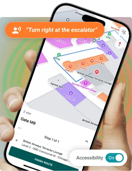
Accessibility is a core part of delivering inclusive passenger experiences. Whether your goal is to meet growing expectations or regulations like the European Accessibility Act, MapsIndoors helps you get there. Through our Partner Hub, you can support travellers with visual, hearing, or mobility needs through intuitive, location-aware indoor navigation — reducing the need for staff escort and enabling more independent travel.
— Prepare for accessibility regulations where needed
— Support travellers with visual, hearing, mobility needs
— Reduce staff reliance through self-guided tools
— Build inclusion into your airport infrastructure

The digital map platform built for airport complexity
Designed to improve passenger journeys, reduce operational strain, and unify digital services.

Guide every passenger step
Show real-time routes to gates, services, restrooms—adapts to changes and conditions.

Personalize with live data
Suggest routes and places based on occupancy, preferences, or wait times.

Navigate from parking to gate
Guide travelers from parking lots to terminals with time and accessibility options.

Enable accessible navigation
Let blind or mobility-impaired travelers move independently via trusted partners.

Plan smart staff task routes
Create efficient, multi-stop routes for cleaning or equipment collection.

Digitize cleaning workflows
Trigger tasks from incidents, occupancy, or schedules to reduce wasteful effort.

Map sensor and device data
Display live data from bins, doors, or traffic sensors to drive smart response.

One map for all users
Give staff and passengers a shared, role-based map to avoid duplication.
Guide passengers every step of the way
Show real-time routes to gates, restrooms, services, and lounges—adapted to gate changes, terminal layout shifts, or mobility needs.
Personalize the journey with live data
Feed the map with occupancy, wait times, or food preferences to suggest the best route, restaurant, or service—based on each traveler’s context.
Help passengers find parking, fast
Guide users from parking lots to terminals with wayfinding that starts from the curb—including time estimates and accessibility options.
Support travelers with accessibility needs
Enable blind, low-vision, or mobility-impaired passengers to navigate independently with self-guided routing via trusted partners in our ecosystem.
Plan multi-stop staff routes
Let staff plan smart task routes—e.g., collecting wheelchairs or strollers across gates—with minimal walking time and priority logic.
Digitize cleaning and maintenance workflows
Route teams based on occupancy, cleaning schedules, or incident reports—minimizing wasted effort and enabling dynamic task assignment.
Visualize smart device data on the map
Overlay sensor data from trash bins, doors, or foot traffic systems to trigger smarter cleaning, maintenance, and space use.
Create a single map for staff and passengers
Avoid duplicated efforts across departments by giving all teams access to the same map foundation—with role-based permissions and views.

Highlight commercial areas and services
Draw attention to restaurants, stores, lounges, or offers with custom icons, categories, or promotional overlays.

Search and filter everything in the airport
Make it easy to find categories like dining, gates, lounges, or services—on web, mobile, or kiosk.

Use the map anywhere
Access the same map on mobile, in your airport app, on kiosks, or through QR code prompts.

Provide the map in any language
Support international travelers with multi-language capabilities built into the interface.

Support airport branding and styling
Style the map with your airport’s colors, fonts, 2D/3D models, and design guidelines.

Track map interactions and usage
See how passengers and staff use the map to understand behavior patterns and optimize experiences.
Ready to rethink your airport map?
Talk to Stevie
or
Christine
.