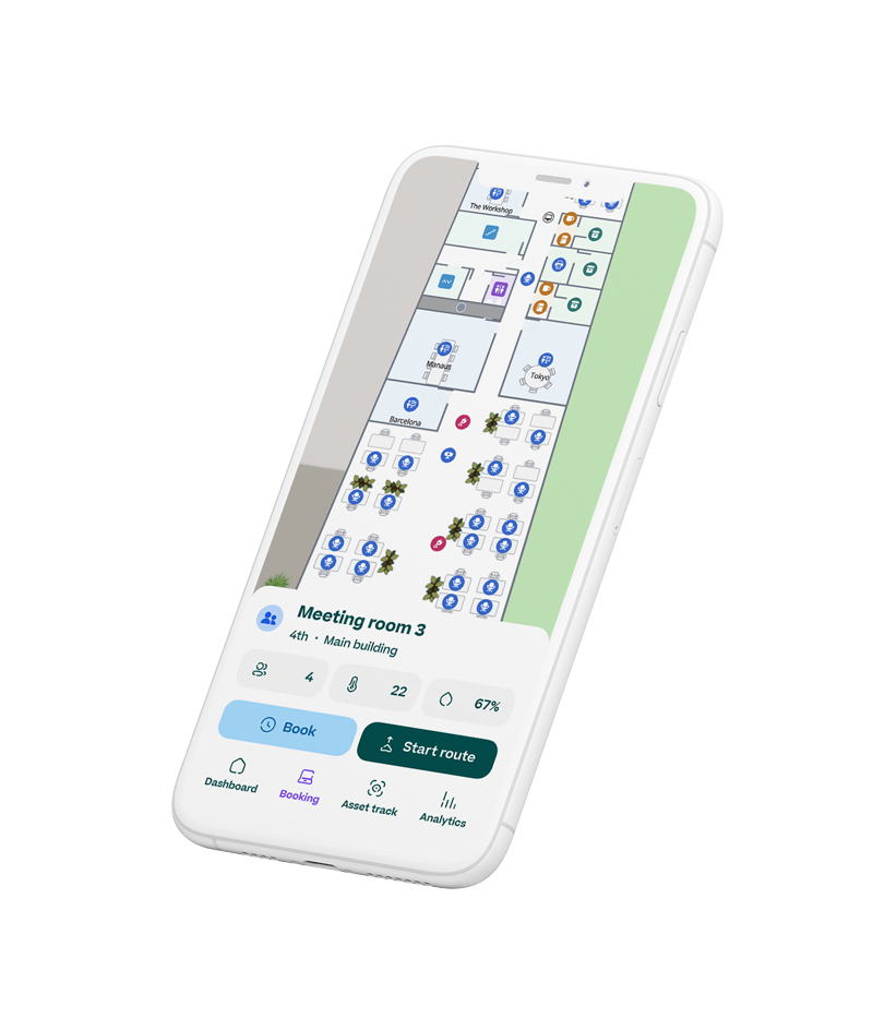
Real-time data on a map of your spaces
From solving complex challenges to locating equipment, MapsIndoors helps you optimize every level of your organization by visualizing important facility data on a map of your spaces in real-time.
Profile-based map views ensure that everyone in your organization has access to the data they need but not to the date that does not concern them.
Real-time asset tracking
Gain real-time awareness of assets' location and condition to ease planned maintenance, prevent breakdowns, and eliminate time wasted searching for the right equipment.
Optimize space utilization
Optimize your workspace utilization by visualizing occupancy data and foot traffic to identify underutilized areas and space optimization opportunities.
Reduce energy consumption
Enhance energy efficiency by visualizing energy usage to identify areas of excessive energy consumption, allowing for targeted optimization.
Free up resources with workspace automation
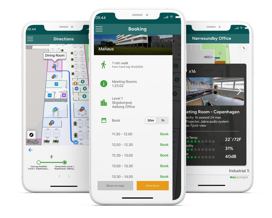
Not enough meeting rooms?
Not having enough rooms is a common problem for most offices. However, it often turns out that it is not the number of rooms that is the problem, but the number of booked rooms that go unused.
A digital mapping platform enables you to automate your workspace so that bookings are canceled if the room or desk is not in use within a certain period of time. Likewise, they will be booked if they are in use even though they have not been booked in advance.

Extend the experience of your IWMS
An integrated workplace management system (IWMS) is a useful tool to manage your building and keep its maps and floor plans up-to-date.
While IWMSs can show interactive floor plans, they are not capable of seamlessly incorporating external data that relies on geographical coordinates. By pairing your IWMS with MapsIndoors, you can georeference the map data and perform geospatial calculations to determine the locations of points of interest on the map.
MapsIndoor can also draw data from your IWMS. This means that you do not need to worry about updating multiple systems when making changes to your building's maps and floor plans in the IWMS. Once changes are made in your IWMS, they will appear on the map.