
InsureTech Connect Asia 2023
Improved visitor experience with interactive maps and smooth wayfinding
Solution
To overcome the challenge of poor wayfinding at previous ITCA events, MapsPeople created an indoor map for the 2023 event. The map covered a space of ~6000 m2, including exhibitor and sponsor booths, and other key points of interest. Everything was connected via route networks drawn by MapsPeople to ensure easy wayfinding inside the venue.
With the use of MapTemplate by MapsPeople, built on top of Mapbox, MapsIndoors was easily integrated into the event mobile application for all visitors to use. Compared to previous years, the map and wayfinding solution for ITCA 2023 gave visitors and sponsors an improved digital experience at the event without the hassle of getting lost.

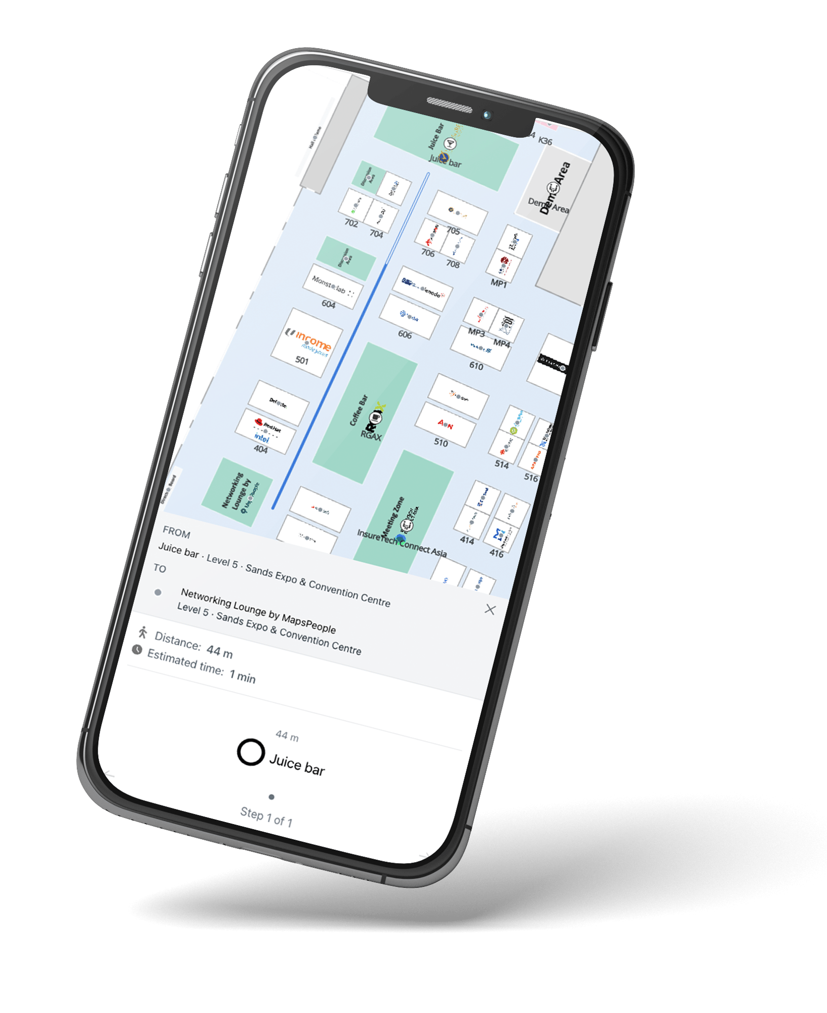
One of the key advantages was the ability for visitors to easily search for specific sponsor booths and other points of interest within the event venue. By simply inputting the name or keywords related to the desired location, attendees could quickly locate the booths of their preferred sponsors, as well as important facilities such as stages, restrooms, and food and beverage areas.
.png?width=800&name=unnamed%20(3).png)
In addition to search functionality, the MapsPeople solution also enabled users to view the distance and estimated walking time between different points within the event space. This feature proved to be invaluable for attendees who wanted to plan their time effectively and navigate the venue efficiently. By knowing the approximate walking time from point A to point B, visitors could better manage their schedules and ensure they didn't miss out on any important presentations, networking opportunities, or exhibitor interactions.
.png?width=800&name=unnamed%20(4).png)
Better visibility for sponsors
The mapping solution offered an excellent opportunity for sponsors to showcase their brand and services. Sponsors were able to have their booth marked with their logo on the map, allowing for easy identification and recognition. Furthermore, sponsors had the option to provide a description of their services and even include a direct link to their website when clicking their booth on the map.
.png?width=800&name=unnamed%20(5).png)
Seamless interaction with mobile app
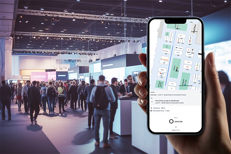
The seamless integration of MapsIndoors into the event mobile application contributed to a smooth and streamlined experience for users. The map loaded within a webview, and users could access it and its features without the need to exit the event app. This eliminated potential disruptions and inconveniences caused by switching between different applications, ensuring that attendees could stay fully immersed in the event while utilizing the map for navigation and information retrieval.
-
We used to get complaints over our static event floor plan. MapsPeople's digital map solved that and we love the wayfinding feature and how easy it is to use. MapsPeople had fast turnaround time and it was a pleasure working with their team, despite the tight deadlines.
 Tricia WongProject DirectorClarion Events Pte. Ltd.