NTU Smart Campus vision
Nanyang Technological University, Singapore (NTU Singapore) is ranked amongst the top universities in the world and it has also been named as the world’s top young university for the last seven years by Quacquarelli Symonds (QS). As part of its Smart Campus vision unveiled in 2018, NTU is a testbed for many emerging technologies.
NTU has been accelerating its digital transformation to meet the changing needs of the University and its employees, to streamline processes and to enhance operational efficiency as part of the NTU Smart Campus vision. Among its many initiatives to improve student, staff and visitor experiences, NTU has introduced an online Campus Map with indoor-outdoor wayfinding to make navigation on its vast 200-hectare campus much easier.
Solution
After in-depth analysis, NTU Singapore selected the MapsIndoors platform, which met all of the University’s requirements as set out earlier.
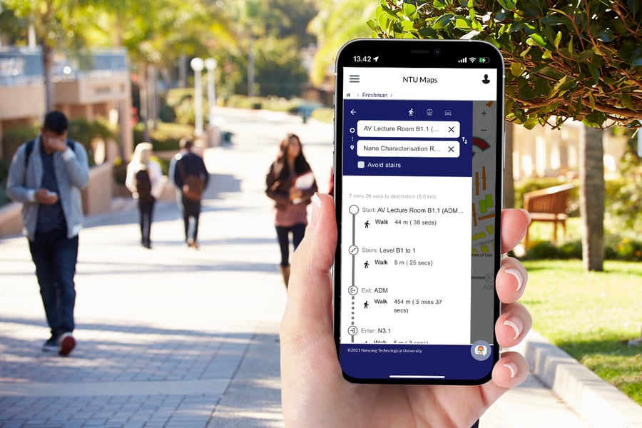
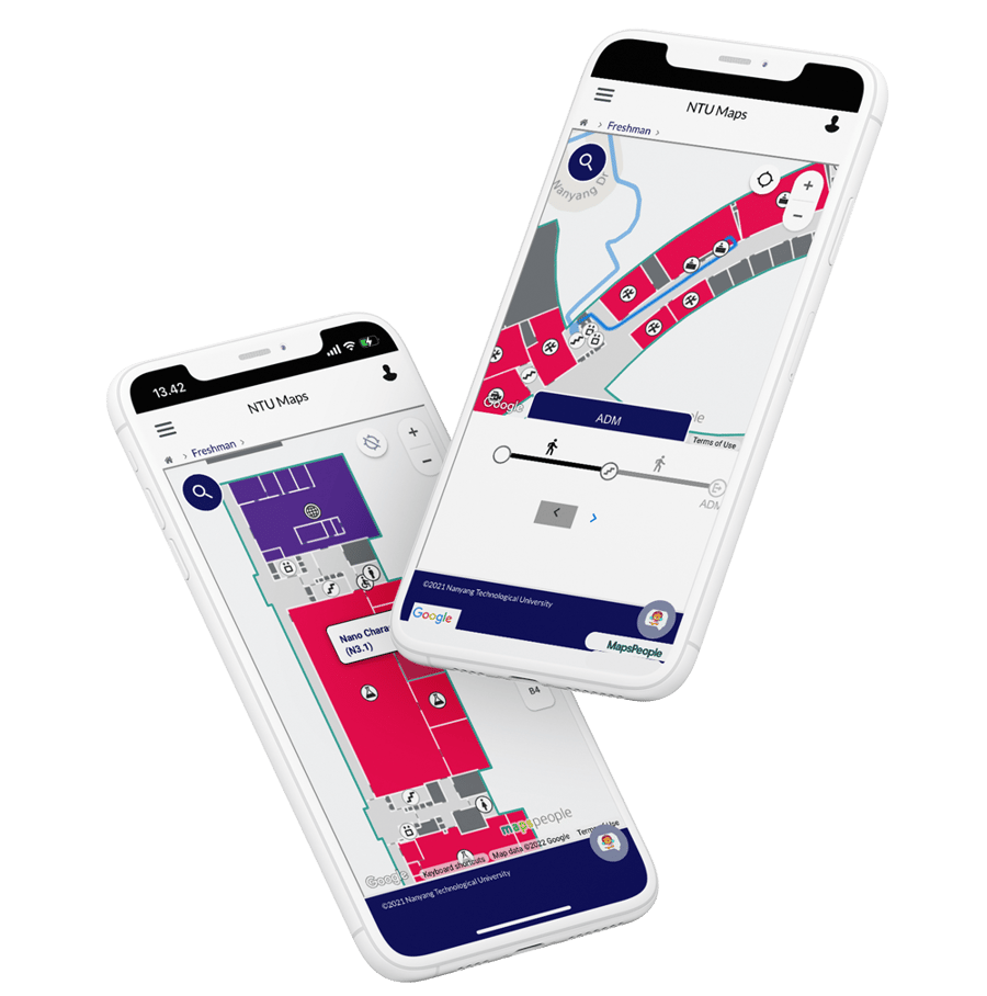
The platform is built with Google Maps technology, which enables seamless outdoor to indoor transitions and ensures quick adoption as MapsIndoors features the well-known functionalities of Google Maps, like zooming and panning, and offers the same familiar user experience.
MapsIndoors was easily integrated into existing apps, kiosks, and websites, making it both mobile responsive and easy to scale. With the included MapsIndoors content management system, NTU Singapore can now easily update, add, and delete Points of Interests (POIs) and areas as well as make changes to routes. The CMS also enables the University to create, edit, and delete categories, aliases, and icons. This afforded the University with extremely simple and effective maintenance of the system and information.
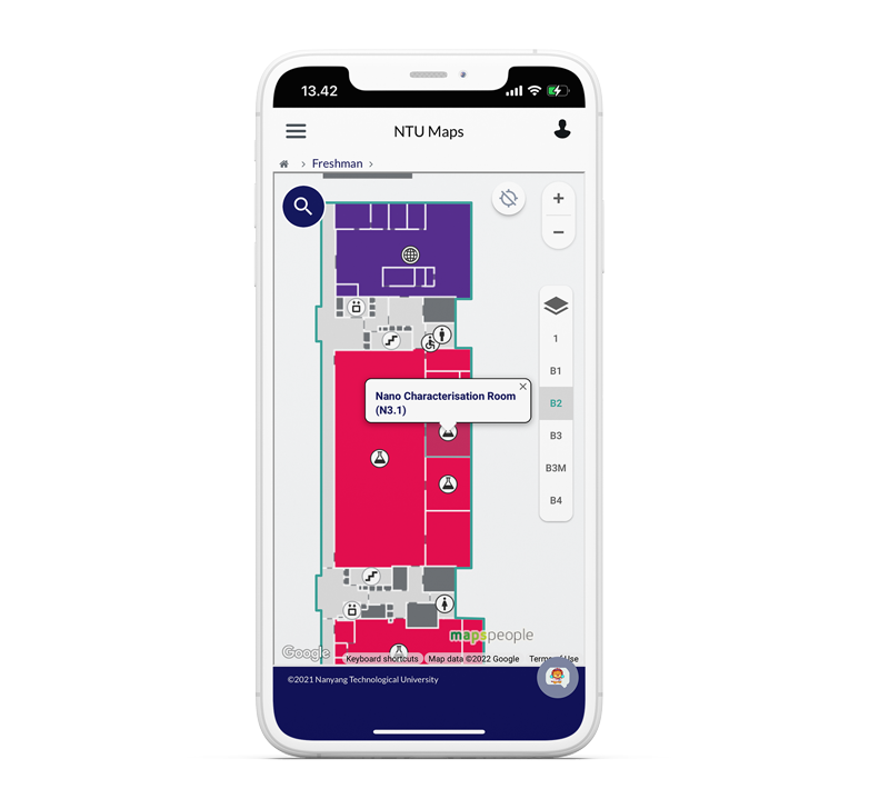
Students, staff, and visitors at NTU Singapore can use MapsIndoors to search for amenities, meeting rooms, and study spaces, and to quickly get directions within the buildings, between buildings and campuses, and even off-site.
-
The MapsIndoors map, built on the industry standard Google Maps Platform, is a very welcomed change with the multi-floor feature that allows people to navigate the whole University campus without feeling lost. This is super important, especially for new students and visitors who may not yet be familiar with the layout and location of tutorial rooms, meeting rooms, and lecture halls. And we all know that we should not be late for lessons!
 Kee HaurTeam Lead, Enterprise IT, Center for IT ServicesNTU Singapore
 -
This Indoor Mapping project exemplifies our Smart Campus vision to harness digital technologies to support better learning and living experiences on campus. In the future, we might expand this solution to cover more buildings and to include features such as heat mapping and AR navigation. NTU Singapore is also considering the possibilities of integrating MapsIndoors into building maintenance app for easier facility management.
Vivienne TanDirector, Enterprise IT, Centre for IT ServicesNTU Singapore
About
The NTU solution includes more than 4,000 POIs and 1 million mapped square meters. It is created by MapsPeople in cooperation with Google Maps and Google Cloud Premier Partner, Searce, who has a team located in Singapore supporting this effort. Searce has been part of the project from the beginning and also provides the ongoing support. This allows MapsPeople to offer NTU Singapore fast, effective, and local support at all times.
About Searce:
Searce is a MapsPeople and Global Google Maps Premier Partner, that empowers clients to futurity their businesses by leveraging location intelligence, Cloud AI & Analytics.